
POLITICAL ALLEGORY OF LOUIS XIV IN A DUTCH MAP OF FRANCE
- geopam

- 24 jun 2025
- 8 min de lectura
Chet Van Duzer
Lazarus Project, University of Rochester, United States. | GEOPAM

In my research on cartographic cartouches, a spectacular cartouche on a map of France by the Dutch cartographer Nicolaes Visscher II (1649-1702) had long impressed me, but its meaning was not clear. Here I present an interpretation of the cartouche, both for its inherent interest and as an object lesson in interpreting the symbolism of cartouches.
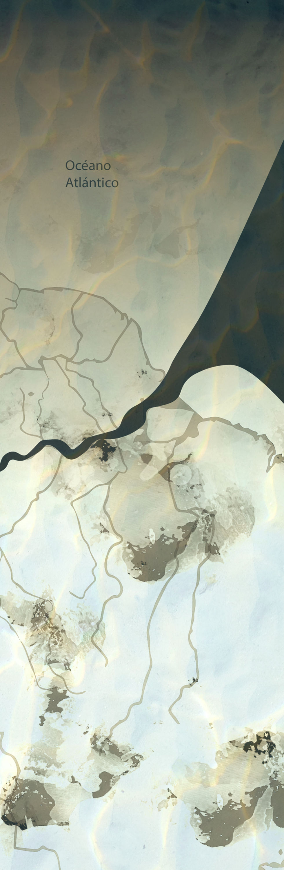
Visscher’s map is titled Galliae seu Franciae tabula, qua omnes provinciae, via angiariae, et aliae res notatu dignae distincte et accurate ostendatur, that is, “Map of Gaul or France, in which all the provinces, main roads, and other noteworthy features are clearly and accurately shown.” It bears no date, but library catalogs ascribe it a date of c. 1680 or c. 1690.[1] In the lower left corner is the title cartouche, which extends along the western coast of France (Fig. 1). Above, the cartouche shows a figure who can only be Phaethon, the mortal son of Helios / Apollo in Greek mythology, who insisted on driving his father’s sun-chariot across the sky for one day, despite his father’s warnings. Because of his inexperience the sun-chariot veered out of control and scorched the earth, and to stop the destruction Zeus struck Phaethon down with a thunderbolt, and his flaming body fell into the River Eridanos.[2]

Figure 1. Detail of the title cartouche on Nicolaes Visscher II, Galliae seu Franciae tabula, qua omnes provinciae, via angiariae, et aliae res notatu dignae distincte et accurate ostendatur (Amsterdam, c. 1680-1690). University of Amsterdam, Allard Pierson, OTM: HB-KZL 32.07.65.
In Visscher’s cartouche we see Phaethon in the chariot aloft in the clouds, with the sun of the sun-chariot right behind him. He has let go of the reins and raised his arms in panic, and he looks down at the earth, clearly concerned about the impending danger. The horses pulling the sun-chariot are out of control, and flames leap from the bottom of the clouds towards the earth. These flames have set two cities and a forest along the coast on fire, and their smoke rises up into the sky. Below, Neptune with his trident emerges from the sea, gesturing for the flames to stop; three female deities on the left are distraught; a god of the sea looks down at the water, and a river-god looks up at the map of France. No water flows from the river-god’s urn: the scorching of the earth has dried up his river. A figure in the shadows who seems to be a goddess of a city who has sunk into the earth looks up at the disaster in the heavens with concern. Below is the inscription Ovid: Metam: Lib: 2. Vers: 191 etc., referring to Ovid’s Metamorphoses, Book 2, lines 191 ff., which is in Ovid’s account of Phaethon, and thus confirms the identification of the scene above.
The question is, what does this scene have to do with France? I had wondered whether it could be an allusion to an important drought or other natural disaster, but it is important to note that the landscape is generalized, there is no attempt to depict a specific city or coastline. It is also significant that there is no explanation of the scene on the map. The lack of geographic specificity and the lack of explanation themselves point us to the explanation: the scene is a political allegory.
In 1672, Louis XIV had launched the Franco-Dutch War and invaded the Dutch Republic; this was known as the Rampjaar (Disaster Year) in the Netherlands. The war continued until the Treaty of Nijmegen in 1678. Louis’s revocation of the Edict of Nantes in 1685 led to increased persecution of Protestants, and in 1689 the Nine Years’ War began, with the Dutch Republic again opposing Louis XIV’s territorial ambitions. Louis was perceived in the Dutch Republic as a vainglorious, over-ambitious tyrant, and his self-identification as the roi-soleil, the sun-god, was well known.[3]
Phaethon was often used as a symbol of excessive ambition, and given Louis’s image as the roi-soleil, and the fact that Phaethon was the son of Helios, it was inevitable that satirists would portray Louis as Phaethon.[4] One example of this identification which pre-dates Visscher’s cartouche may be found in the frontispiece of the German pamphlet Der Erfährte Hahn, Oder Kurtze Vorstellung des jenigen, was muthmassentlich von dem außgang dieses blutigen Kriegs zu hoffen, ob Franckreich sein vorgesetztes Ziel erreichen werde? (“The Experienced Rooster, or A Brief Presentation of What Might Be Hoped for from the Outcome of This Bloody War: Will France Achieve Its Intended Goal?”) (Freystadt, 1678) (Fig. 2).[5] The scene shows a slightly later moment in Phaethon’s story than Visscher does: here the sun-chariot has just disintegrated, and Phaethon, the horses, and pieces of the chariot tumble from the sky, with some fleurs-de-lis accompanying them, to identify Phaethon as Louis XIV. Above, emerging from the clouds, are the words “tamen mangnis [sic] excit ausis,” a quotation from Ovid’s account of Phaethon, Quem si non tenuit, magnis tamen excitit ausis, “Even if he did not succeed, he perished in a great attempt;”[6] below, we see cities on fire as in Visscher’s cartouche.

Figure 2. Frontispiece of Der Erfährte Hahn, Oder Kurtze Vorstellung des jenigen, was muthmassentlich von dem außgang dieses blutigen Kriegs zu hoffen, ob Franckreich sein vorgesetztes Ziel erreichen werde? (Freystadt, 1678), Munich, Bayerische Staatsbibliothek, Res/4 Eur. 375,41.
Another example of this iconography printed after Visscher made his map may be seen in the frontispiece of the pamphlet Ptolomeus, Copernicus, en Merkuur op de Parnas over de zon en de waereld (“Ptolemy, Copernicus, and Mercury on Parnassus discussing the sun and the world”) (Amsterdam, 1701) by Romeyn de Hooghe (1645-1708), the Dutch painter, sculptor, engraver, and caricaturist. In his frontispiece (Fig. 3),[7] Louis XIV as Phaethon, with the sun behind his head and the constellations around him, rides in a sun-chariot with broken wheels and a commode for a seat, and leans on crutches; the chariot is driven by Madame de Maintenon, Louis’s second wife. Above, the imperial eagle of the Holy Roman Empire seizes half of the reins, and below, the Dutch lion seizes the other half, with the unicorn of England watching from below. A disabled Louis, whose wife was guiding his sun-chariot, is shown having all control of his ambitious plans taken from him.

Figure 3. The frontispiece of Romeyn de Hooghe, Ptolomeus, Copernicus, en Merkuur op de Parnas over de zon en de waereld (“Ptolemy, Copernicus, and Mercury on Parnassus discussing the sun and the world”) (Amsterdam, 1701). Amsterdam, Rijksmuseum, RP-P-OB-55.023.
There can be no doubt of the political message implicit in Visscher’s map: the Dutch cartographer is criticizing and satirizing Louis XIV’s overweening ambition, likening him to a boy in over his head, and suggesting that his actions will damage his country.
Visscher’s cartouche satirizing Louis XIV inspired an imitator: the Dutch cartographer Carel Allard (1648-1709) in his map of France, Totius Regni Galliae sive Franciae Tabula: cum suis provinciis, urbibus, pagis, angariis, etc. (“Map of the Entire Kingdom of Gaul or France: with its provinces, cities, villages, postal routes, etc.”) (Amsterdam, c. 1695), also includes a title cartouche with an allegory of Louis XIV as Phaethon (Fig. 4).[8]

Fig. 4. Detail of the title cartouche of Carel Allard’s, Totius Regni Galliae sive Franciae Tabula: cum suis provinciis, urbibus, pagis, angariis, etc. (Amsterdam, c. 1695). Royal Danish Library, KBK 2-2.
Allard includes Zeus above, astride his eagle, holding a thunderbolt which he is ready to hurl at Phaethon; strangely, Zeus is accompanied by a personification of France who holds a spear and a shield with three fleurs-de-lis which is labeled Galliae Insigne. France thus seems ready to attack her own king, if Allard understood Visscher’s cartouche as referring to Louis XIV. Below, Phaethon is just starting to lose control of the sun-chariot, and below him, the hair of three figures, perhaps representing cities, is catching on fire. At the bottom of the title cartouche, three river gods are distraught.
Cartographers often copied cartouches from their colleagues’ maps; in some cases they revised them to give them richer symbolism, but in this case the derivative nature of Allard’s cartouche is palpable.
Notes
[1] On Visscher’s map see Cornelis Koeman, Atlantes Neerlandici (Amsterdam: Theatrum Orbis Terrarum, 1967-85), vol. 3, p. 181. On the Visscher family of cartographers see Huigen Leeflang, “The Sign of Claes Jansz Visscher and his Progeny. The History and Significance of a Brand Name,” The Rijksmuseum Bulletin 62 (2014), pp. 240-269.
[2] There is discussion of the myth of Phaethon in Peter E. Knox, “Phaethon in Ovid and Nonnus,” Classical Quarterly 38 (1988), pp. 536-551.
[3] Agnès Joly, “Le Roi-Soleil, histoire d’une image”, Revue de l’histoire de Versailles et de Seine-et-Oise 38 (1936), pp. 213-235; also see Gérard Sabatier, “La gloire du roi: iconographie de Louis XIV de 1661 à 1672”, Histoire, Economie et Société 19.4 (2000), pp. 527-560.
[4] On Dutch satirical images of Louis XIV see P. J. W. van Malssen, Louis XIV d’après les pamphlets répandus en Hollande (Amsterdam: H. J. Paris; and Paris: A. Nizet & M. Bastard, 1937); also see Peter Burke, “The Reverse of the Medal,” in his The Fabrication of Louis XIV (New Haven: Yale University Press, 1992), pp. 134-149; Brittany Nicole Heinrich, “Satirical Imagery of the Grotesque Body of Louis XIV: Pushing the Corporeal Limits of France,” MA Thesis, McGill University, 2006; and Isaure Boitel, “Du barbare à l’oppresseur décrépi: l’image du Louis XIV guerrier dans les satires anglaises et hollandaises,” Cahiers de la Méditerranée 83 (2011), pp. 125-134. I have discussed an English satirical image of Louis XIV in Chet Van Duzer, “Shouldering the World in a Different Way: Early Modern Images of People Wearing Maps,” Word & Image 40.4 (2024), pp. 238-253.
[5] For discussion of the frontispiece in Der Erfährte Hahn see Heinrich, “Satirical Imagery” (see note 4), pp. 36-38 and 49-52. The exemplar of the pamphlet in Wolfenbüttel, HAB, Ad 84 (2), lacks the frontispiece, but that in Munich, Bayerische Staatsbibliothek, Res/4 Eur. 375,41, does have it, and is digitized at https://www.digitale-sammlungen.de/en/details/bsb10891843.
[6] Ovid, P. Ovidi Nasonis Metamorphoseon libri XV, ed. Hugo Magnus (Berlin: Weidmannos, 1914), Book 2, line 327, p. 63.
[7] For discussion of de Hooghe’s frontispiece see Henk van Nierop, “Lampooning Louis XIV: Romeyn de Hooghe’s Harlequin Prints, 1688-89,” in Tony Claydon and Charles-Édouard Levillain, Louis XIV Outside In: Images of the Sun King beyond France, 1661-1715 (Farnham, Surrey, UK: Ashgate, 2015), pp. 134-152, at 134. A high-resolution image of the frontispiece is available on the website of the Rijksmuseum, at https://id.rijksmuseum.nl/200204571.
[8] Allard’s map appeared in his Atlas Major, in vol. 5, plate 20. A high-resolution image of the map is available on the website of the Royal Danish Libary, at http://www5.kb.dk/maps/kortsa/2012/jul/kortatlas/object60360/en.
About the author

Chet Van Duzer is a board member of the Lazarus Project at the University of Rochester, which brings multispectral imaging to cultural institutions around the world. He has published extensively on medieval and Renaissance maps; his recent books
include Henricus Martellus’s World Map at Yale (c. 1491): Multispectral Imaging, Sources, and Influence, published by Springer in 2019, and Martin Waldseemüller’s Carta marina of 1516: Study and Transcription of the Long Legends, published by Springer in 2020. His book about cartographic cartouches, titled Frames that Speak: Cartouches on Early Modern Maps, was published by Brill in Open Access in 2023, and is available here.


Esta obra está bajo una Licencia Creative Commons Atribución-NoComercial-CompartirIgual 4.0 Internacional.


Comentarios